

Charlottesville Holds Hidden Wilderness
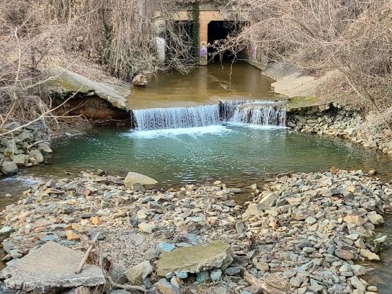
Charlottesville is big and getting bigger all the time. As of the 2020 census, there were 46,553 people living within the city itself. Countless others live in the surrounding counties but work in the city. The combination of thousands of people and continually expanding housing developments can make the wilds of Virginia seem far away. If only the commuters sitting in traffic knew that just blocks away, cool forest and a rushing river were waiting to welcome them.
The Rivanna Trail is comprised of 20 miles of walking, hiking, and biking paths that almost completely surround the city of Charlottesville in a loop. The trail system includes a section which runs through Pen Park, Dunlora, and Belvedere called the River North Trail. It is built and maintained by the Rivanna Trail Foundation (RTF), a volunteer organization.
There are multiple access points throughout the city. Every section of the trail, can be found on the RTF’s trail guide page, which includes mileage and pertinent information about the footing. The trails range in difficulty but all trails within the system are classified by the RTF as either moderate or easy. However, these designations are intended for walkers and hikers; mountain bikers are welcome, but there are some sections which may not be suitable.
Because the trail does sometimes pass through private property, there have been instances of property disputes. Some of these disputes have gone to court and ended in settlements such as Shirley Presley v. City of Charlottesville and Rivanna Trails Foundation (2006). Because of the occasional disputes, the trail does not run in an unbroken line. Some sections require users to traverse through neighborhoods before re-entering the trail where it picks up again. The RTF asks that trail users be mindful and respectful of the fact that they may sometimes be accessing land that is privately owned.
Most of the trail is forested dirt paths, but there are some sections, such as Riverview Park to Holmes Avenue, that are fully paved and accessible to those with strollers or limited mobility.
There are multiple ways to find maps of the Rivanna Trail. It can be found on Google Maps or the app Avenza. The RTF offers a link to download the Avenza app on their website as well as a scannable QR code. The Rivanna Trails Foundation also offers a downloadable PDF on their Trail Maps & Apps page. The RTF notes on their website that the downloadable map is not as detailed or up-to-date as the online versions.
For those interested in volunteering their time to the upkeep of the Rivanna Trail, the RTF hosts work parties from 9-11:30 a.m. on the second Saturday of each month. They meet at 2030 Morton Drive at the RTF equipment shed. More information can be found on the Rivanna Trail Foundation Events page.